

| QR code: |

|
in pdf format
Mission
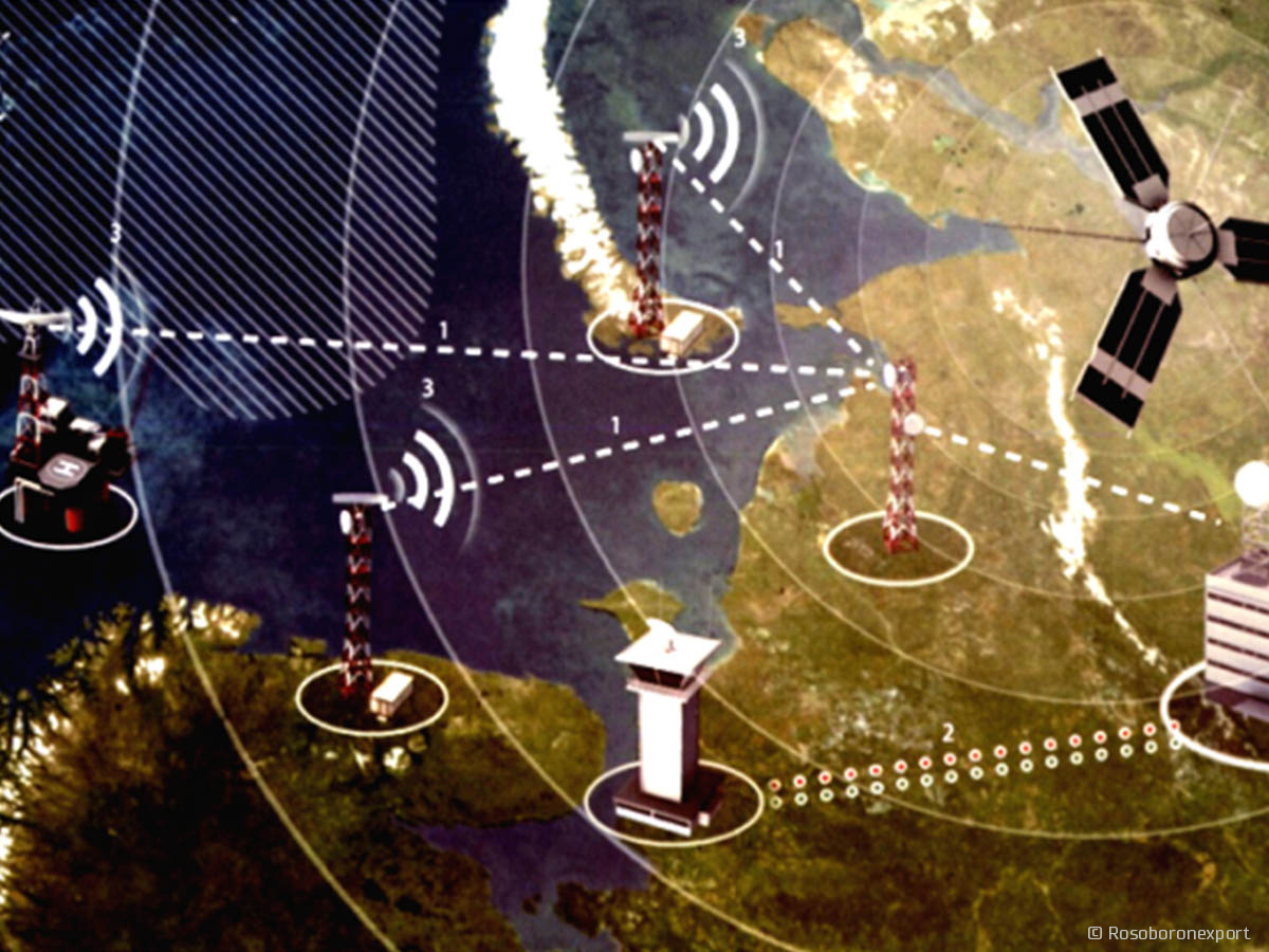
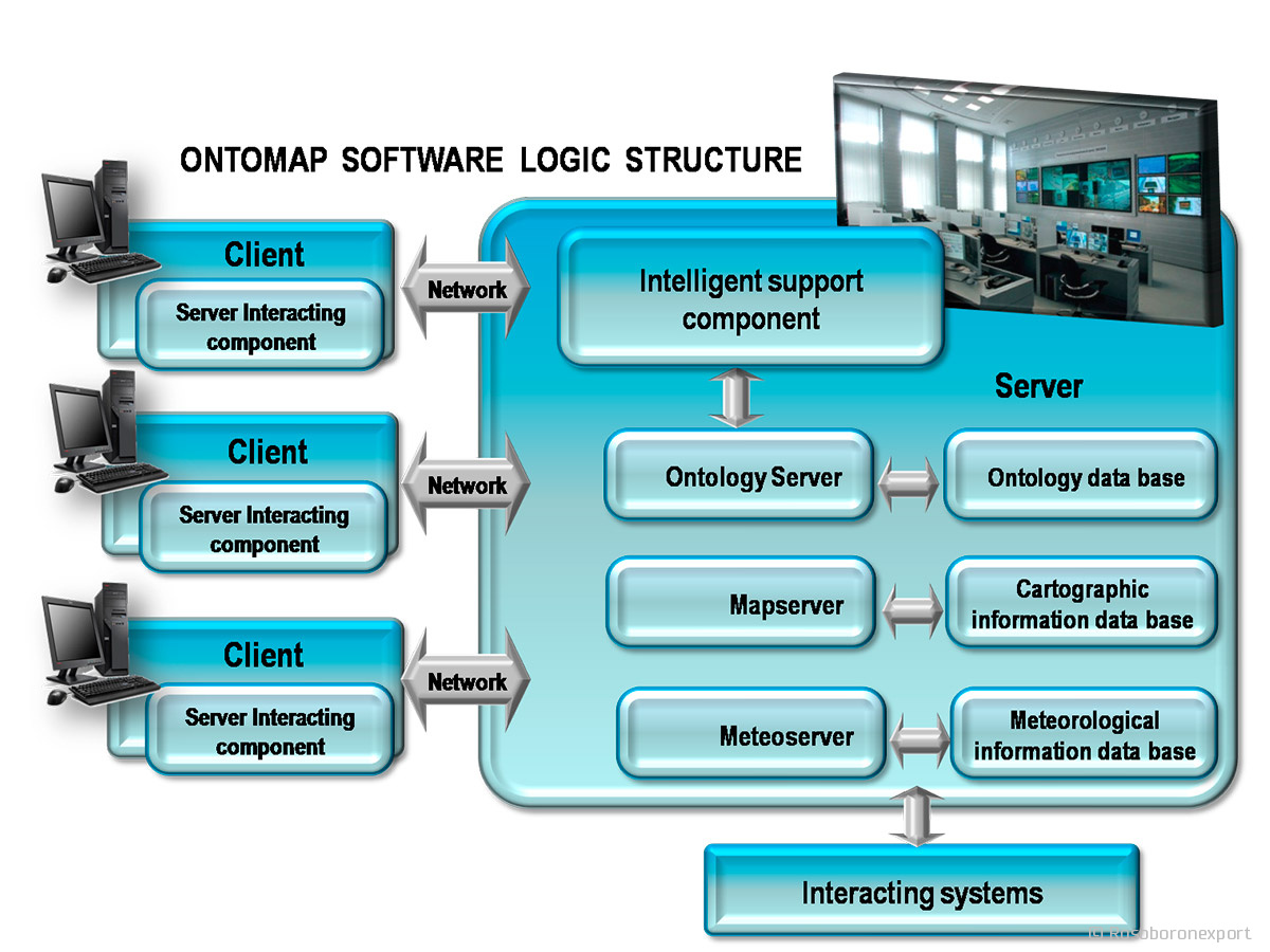
The Ontomap intelligent geo-information software complex for situation awareness and situation assessments (SA) is destined for information, model, graphic and expert support of roles by managing officials at all surveillance situation levels. Surveillance & recognize systems` software form an information basis for a naval integrated automated control system.
Features
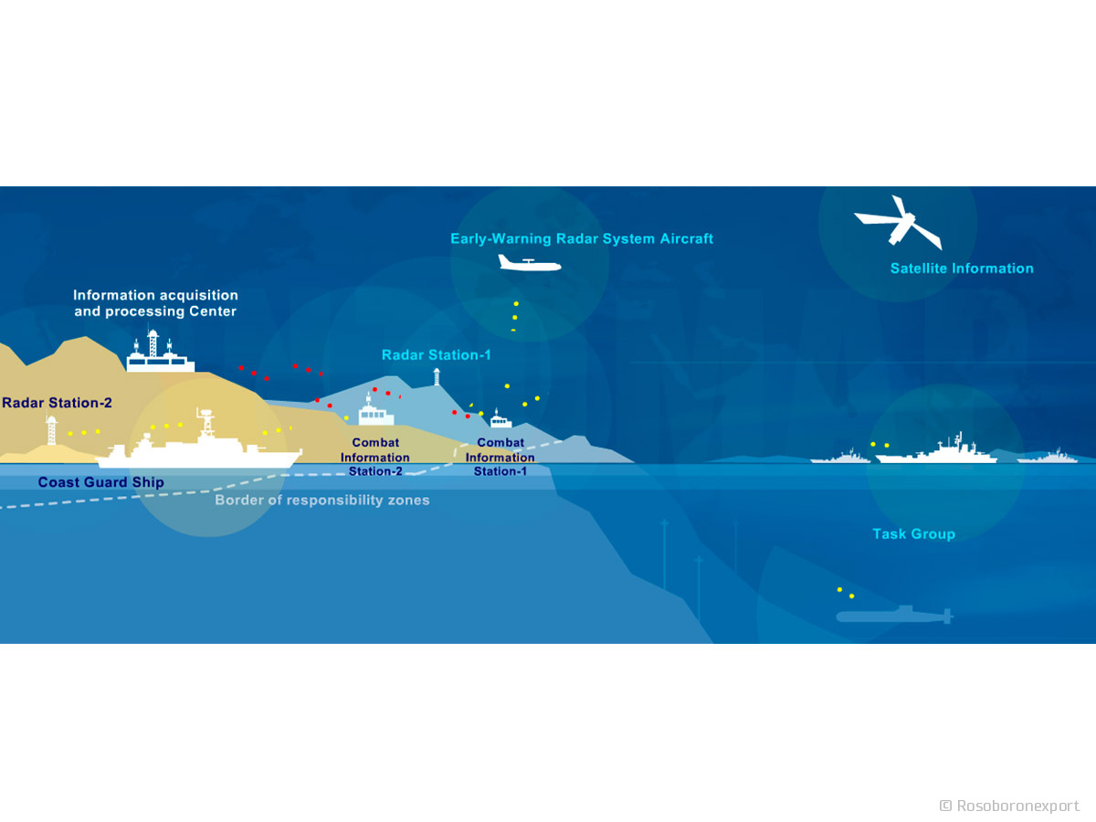
The software package is designed for information, modeling and graphic types of support of the control bodies of naval and coast guard surveillance systems. The Ontomap software package provides interface and surveillance data collection, processing and issuance via horizontal and vertical levels of naval control systems and solves following functional tasks:
1. Acquisition, processing, storing and documenting information arriving from detecting facilities, maritime observation systems and interacting systems in regard to surface, underwater, hydrometeorologic, mine, chemical, bacteriologic, and radiation situation.
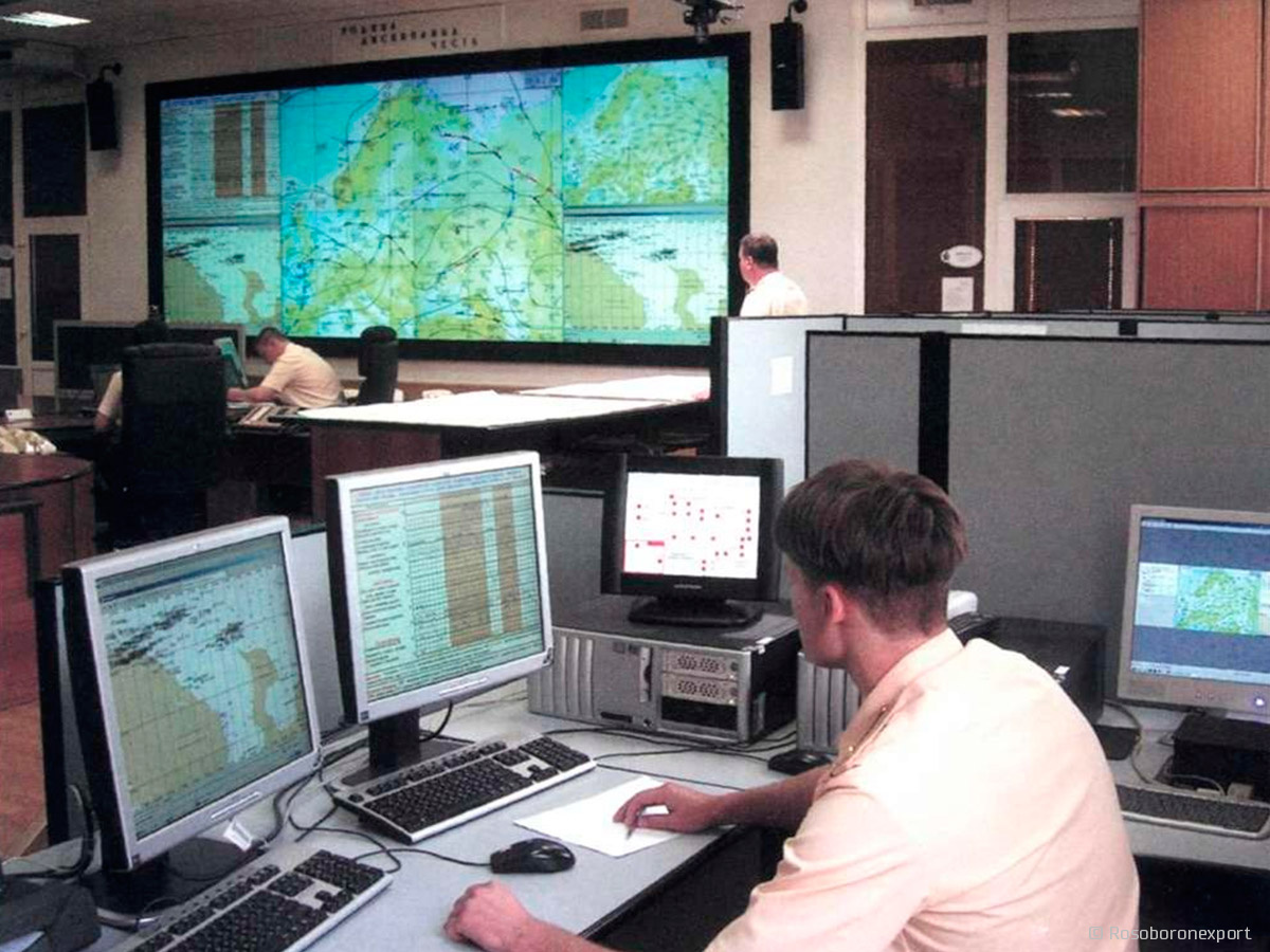
2. Representing a dynamical map of sea situation with due regard to given time characteristics on information screening private use media and information screening collective use media.
3. Predicting targets’ locations for a given time moment within one nautical day limit with due regard to navigation conditions in a region.
4. Input, storage, display and issuance of reference data, including the characteristics of both friendly and hostile ships, as well as information on combat readiness and state of weapons of ships operating in the AORs of naval bases and home stations.
5. Acquisition, storing and screening the information reflecting the state of detection and communication facilities. Control of detection facilities’ operating functions.
6. Calculation and output of data aimed at providing for protection of ships and vessels sailing under constrained conditions and in navigation dangerous areas; solving tasks of tactical maneuvering.
7. Providing for ships and vessels navigating, calculating parameters and data necessary for objects’ search and maneuvering forces targeting to detected objects with due account of navigation conditions within coast observing systems responsibility zone.
8. Notification within normative time periods and necessary information transfer to Naval Base operative officer in emergencies.
9. Storing, correction and output of the necessary reference information about combat training and relocations’ plans.
10. Information fusion and target tracking according to six level architecture (JDL model).
Capabilities
Functional capabilities of software package makes it possible:
- entering graphic objects and their parameters (designation, course and speed of moving objects and their status form) onto the various formats of charts (S57, VPF, SXF) and controlling them;
- time-based modeling of moving objects’ travel;
- calculation of the range of shipborne or shore-based radars or radar groups against single and multiple surface, aerial or sea-skimming targets with due account for active and passive countermeasures under the actual radar conditions of the environment;
- playing over scenarios of objects’ actions in real time and in randomly assigned timescales, as well as generation and issuance of recommendations and system operation forecasts to the decision-makers during war-gaming, situational analysis and personnel training as well as when trying different scenarios and conducting research planning.
A distinctive advantage of the Ontomap software system from similar systems are multilevel processing and integration of heterogeneous data received from various data sources (global, national and departmental information systems), process them using a single model representation of objects in the monitoring of the marine environment in line with the JDL model by ontology.
| QR code: |
|
in pdf format